
Search a Stark County Street
A street-by-street search in Stark County is a record trail, not a roll of households. The Auditor’s address tool accepts a number, street name, or direction, and its official help says to omit the suffix for better results. A street-only query can return matching parcels. Confirm the direction and the city, village, or township before choosing a result, because a postal city label does not set the governmental record jurisdiction. Start with the parcel that matches the address, then keep the parcel ID and legal description with the street line.
- Enter the address or road name in Auditor Public Access without the street suffix. Use
*to browse uncertain spellings or a group of addresses. - Open the selected Stark County profile and separate the parcel location, assessed owner, tax mailing name and address, and legal description.
- Use the Stark County parcel map to compare the property with the next parcels on the street. The map is a land-record tool, not a list of household members.
- Search the Stark County Recorder by the owner or prior party name, then match the instrument’s legal description to the parcel before following a grantor backward.
- For a dated listed name at an address, consult the Haines Criss+Cross Directory at Stark Library and then the alphabetical Canton City Directory for the same edition.
Note: A tax-mailing field can route county correspondence to another place, so it should never be relabeled as proof of residence at the parcel.
Stark County Street Directory Parcels
The Stark County Auditor Public Access site is the primary address-record entry point because it joins a parcel to an address. Its Basic search supports Parcel ID, Owner, and Address. The full parcel ID has 10 characters without spaces, though a partial ID works. Owner search expects LastName FirstName with no comma. Address search permits a number, name, or direction. An ending wildcard is assumed in owner search, and an embedded wildcard can help with uncertain spelling.
| Auditor Field | Input Type | Use in a Street Search | Format Note |
|---|---|---|---|
| Address | Text | Find a number, road name, or direction | Leave off the suffix; street-only input can return a road’s parcels. |
| Parcel ID | Text | Return to a selected parcel | Ten characters without spaces for a full ID; partial values work. |
| Owner | Text | Check an assessed ownership entry | Use last name then first name without a comma. |
| Group | Dropdown | Begin an Advanced search | Residential/Agricultural or Commercial. |
| Criteria and value | Dropdown and contextual fields | Add a selected Advanced criterion | Multiple ZIP values use commas without spaces when that criterion is available. |
After selection, the profile can show parcel, owner, tax mailing name and address, legal, credits and programs, property inspection and reviews, values, sales, tax summary, land, sketch, and maps. Read each label literally. The tax mailing entry may be valuable for Stark County record routing, but it is not the situs address and it does not identify every person along a Stark County street.
Map a Stark County Street
Stark County GIS adds the shape and setting that an address result lacks. The county provides Basic and Advanced Parcel Viewers through its GIS gateway, with public maps, downloads, and how-to videos. Select a parcel from the Stark County property results, open the map, and use identify to return details. The official map guide documents freehand, point, and box selection plus area, distance, and point measurement. Those controls help place a lot in relation to the street and adjacent parcels without turning map boundaries into resident facts.
Open the Stark County GIS viewer gateway to choose the Basic or Advanced Parcel Viewer.
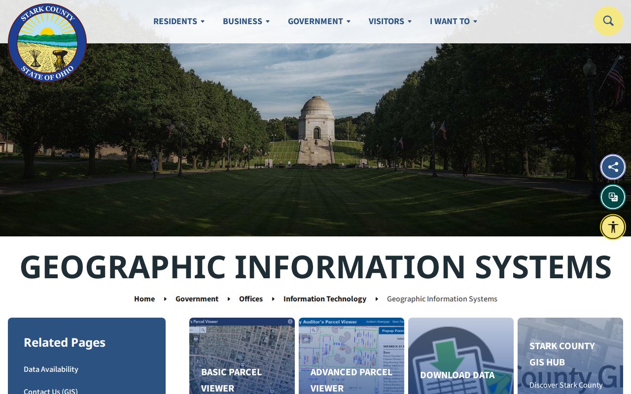
The documented layer list includes parcels, roads and addresses, tax-map annotations, contours, flood plains, neighborhood, tax-map boundaries, zoning, and aerial imagery. Use those layers to check the parcel context. They do not identify household members.
Stark County Street Deed Chains
A Stark County parcel record becomes a deed trail when its legal description moves into the Recorder’s index. In Recorder CountyFusion, enter a party name as LAST NAME FIRST NAME without punctuation. The official quick guide says result rows show Instrument #, Book, Page, Recorded, Document Type, Name, Other Name, Legal Description, and Marginal. Open the instrument number, then compare its legal description with the Auditor profile before treating it as the parcel’s conveyance.
The grantor on a purchase deed can be the next name in a backward chain, but legal-description continuity matters when lots split, merge, or enter a subdivision. A plat may supply lot, block, subdivision, or survey language that an address omits. The online quick-name result range begins in 1982, while county land records begin in 1809. For an older transfer, ask the Recorder, library, or archival custodian for the book, page, index, or microfilm route. A sale record proves a recorded role on its date, not continuous residence after that sale.
- Parcel
- A county property unit with an identifying number used in assessment and mapping systems.
- Situs address
- The physical location of the parcel, kept distinct from the address used for tax correspondence.
- Plat
- A recorded map that can describe lots, blocks, subdivision layout, and legal-property boundaries.
- Criss-cross directory
- A dated address-to-listed-name directory, unlike an alphabetical name directory.
Stark County Street Permit Records
Permit and code files can add a project-specific fact to a Stark County street search. The Stark County Building Inspection screen accepts Project Street Number, Project Street Name, Owner Last Name, Owner First Name, Contractor Name, or Permit or Invoice, and requires at least one search criterion. It is a lead to public project activity, not a full history of a parcel or a list of everyone present at the address. File details may require the department’s help.
See the county permit-charge search for the available address and name fields.
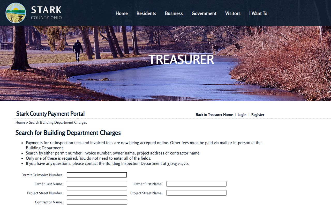
The Stark County form can narrow a project by street elements, which makes it a useful separate record layer after the parcel and deed have been matched.
For Canton, see the Code Enforcement source for the municipal permit and inspection route.
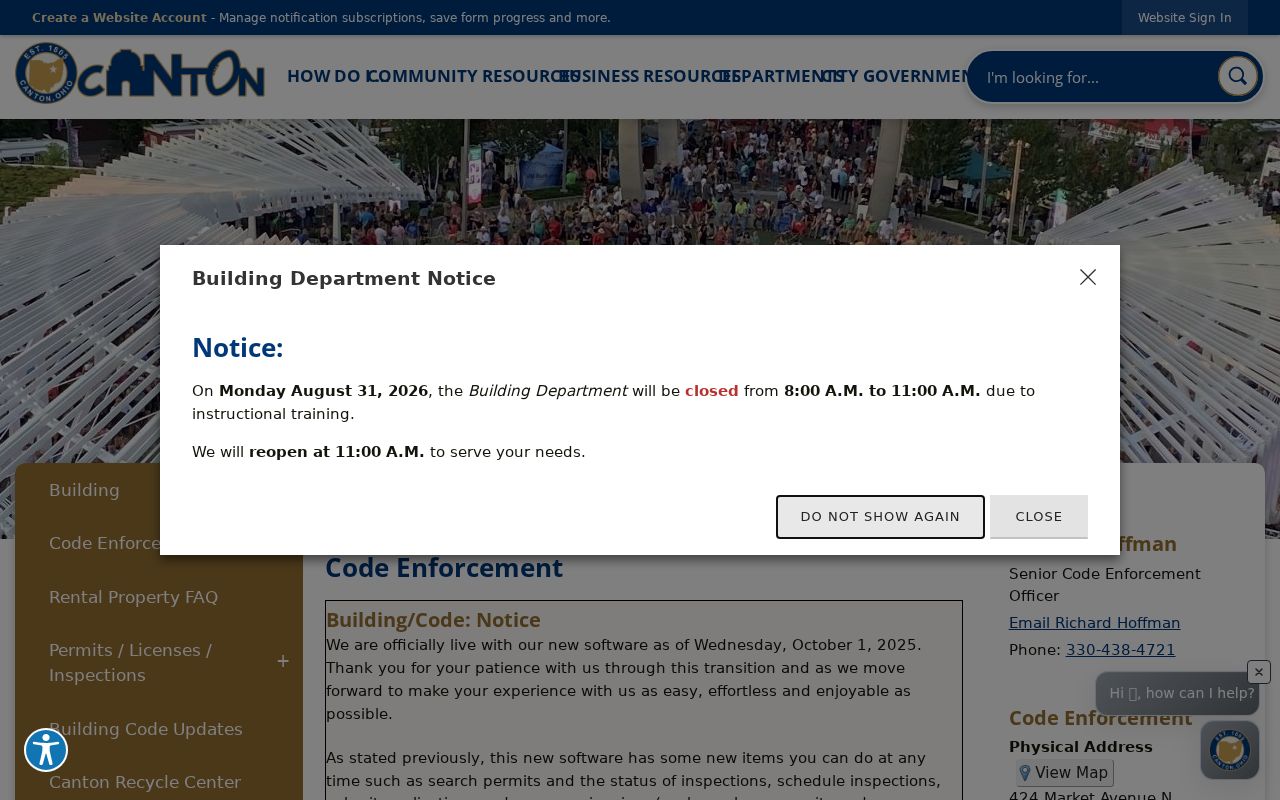
Canton’s iWorQ portal covers plans, permits, and inspection records created October 1, 2025 onward. For older city activity, call 330-430-7800 or submit a tailored public-record request with the address.
Use the Canton permit-status portal only for its documented recent coverage.
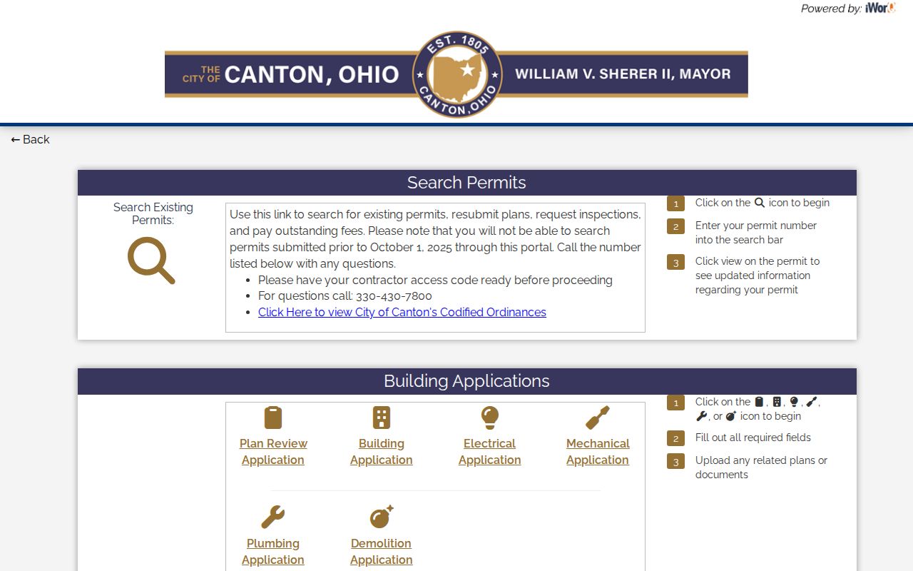
The date cutoff is a real access boundary, so an empty recent portal result is a reason to use the city’s phone or request channel for an older record.
Stark County Street Address Authorities
Address assignment in Stark County depends on the parcel’s geography. The Regional Planning Commission House Numbering office assigns official house numbers in unincorporated areas, while cities and villages assign them within their own limits. A property must be a legal record before a number is issued. Condominiums must first be declared through the Auditor, and commercial development needs subdivision-review approval. That split matters when an old street record has a postal city name but the parcel lies outside that city’s authority.
Consult the Stark County house-numbering source when a number, map, or jurisdiction is in doubt.
The county says a number is obtained before a new building permit. Its listed fee is $15 per address, and its page directs callers to verify the appointment location because it presents more than one location reference.
Stark County Street Record Sources
Address-keyed Stark County sources overlap, yet they do not give the same answer. The county record chain works best when the source is matched to the question: parcel ownership, a mapped boundary, a recorded conveyance, a project record, a permitted voter record, or a dated directory listing. The table keeps those limits visible before a street result is treated as a household claim.
| Street Source | Search Key | What It Shows | Access Limit |
|---|---|---|---|
| Auditor address search | Number, street, or partial street | Parcels and assessed owner profile | Not all occupants or a verified mailing recipient. |
| GIS viewer | Map address, parcel, or selection | Adjacent parcels, layers, and map geometry | Not household members. |
| Recorder index | Party, instrument, legal description | Recorded conveyance and encumbrance chain | Not continuous residence after a sale. |
| County Building Inspection | Project street number or name | Permit or invoice lead with project fields | Full file detail can require department contact. |
| Canton code portal | Permit or inspection record | Municipal activity after October 1, 2025 | Older portal records need a phone or request route. |
| Voter route | Individual name and date of birth, or county/day file | Public registration evidence where permitted | Not an anonymous street-browse tool; protected fields stay closed. |
| Haines Criss+Cross | Address in a dated edition | Listed historic name at that address | Not legal ownership or every resident. |
Stark County Historic Street Records
For a past street resident, use the Haines Criss+Cross Directory at Stark Library’s Stark County Family & Local History collection as the address-to-name layer, then compare the alphabetical Canton City Directory for that year. The two directory forms serve different purposes. A criss-cross entry begins with the street address and can lead to a listed name. The alphabetical volume can add the edition’s listed name-address relationship and other printed details. Neither replaces a deed chain, and neither includes every person living in Stark County.
Stark Library’s Family and Local History sources also include historic newspapers, Canton City Directory material, maps, census resources, and local index files. The Canton directory was annual in some periods, biennial in others, and had a three-year World War II gap. A dated result should therefore be read as evidence from that edition, not as a year-by-year continuous list.
Stark County Street Postal Names
Mail-delivery names can complicate a Stark County address-record search. USPS ZIP Codes are not municipal or county boundaries, and USPS says a ZIP lookup does not confirm that a person or business is at an address. In 2006, the Postal Service changed the preferred last line for 44720 from Canton to North Canton and for 44730 from Canton to East Canton. An older deed, directory, license, or voter record can therefore use Canton where a current address format uses another preferred city name.
Use USPS for delivery formatting, the Auditor and GIS for parcel geography, and the municipal or county address authority for the official house number. That three-part check keeps a postal-name change from being mistaken for a move or a new jurisdiction.
Stark County Street Record Limits
Public Stark County parcel and deed records are not a complete list of occupants. A parcel profile can name an assessed owner and a tax-mailing contact. A Recorder instrument can name parties to a document. A Haines entry can name a person listed at an address in one historic edition. Those facts answer different questions. County Voter View requires a surname and date of birth, rather than offering a street list. Utility customer lists are not a public fallback under Ohio law, and protected voter registrations and Safe at Home information remain confidential.
Lawful use. Use address records for personal, lawful research and respect redactions. Stalking, harassment, intimidation, or republishing a protected address is prohibited.
Stark County Street Record Fallbacks
An online no-result can mean the record belongs to another custodian, falls before an online cutoff, or needs a narrower request. For Stark County Recorder material before the 1982 name-result range, ask about older books, indexes, or microfilm. For Common Pleas material before the 1985 computerized docket, use the Clerk’s sixth-floor index route. For a Canton permit older than the October 2025 portal coverage, call Code Enforcement or file a specific city request. For historical street names, Stark Library’s Stark County local-history resources are the documented repository route.
Ohio’s Public Records Act, R.C. 149.43, generally allows requests for existing public records, subject to exemptions and redaction. Describe the Stark County address, record type, and approximate date. The custodian can then identify whether a counter record, a mail copy, an emailed record, library material, or an archival series is the proper next channel. A full named-street trail needs the parcel sequence, while a single name is better handled through a court or vital-record verification route.